
Cartography viewer / Scales of analysis
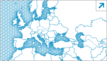
International scale
Geographical scope: from the North of Europe to the South of the Canary Islands, including the waters of the northeastern Atlantic, the Mediterranean and the Black Sea, and countries in Asia, Africa and Europe.
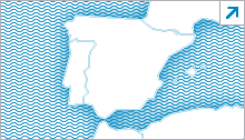
National scale
Geographical scope: All Spanish jurisdictional waters, which extend from north to south from the boundary between the Spanish and French EEZs in the Bay of Biscay to the southern limit of the EEZ generated by the Canary Island archipelago. From east to west from the delimitation of the continental shelf between Spain and Italy to the westernmost outer limit of the Canary Islands EEZ.
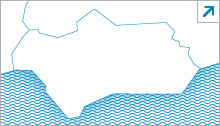
Sub-regional scale
Geographical scope: Spanish waters corresponding to the Gulf of Cadiz and the Alboran Sea, from the border with Portugal in the mouth of the Guadiana River to the south of Cape Gata, including the Straits of Gibraltar.
Design and development of viewers
Gabriel Orozco Frutos
Juan Manuel Martín Jiménez