
 |
BACKGROUND The MARINEPLAN website is motivated by the phenomenon of the international spread of new maritime policies and planning initiatives. This process began with the Green Paper (2006) in the European Union and in Spain with Law 41/2010 on the protection of the marine environment, which transposes the Directive on Marine Strategy (2008) into national law. |
 |
RESEARCH IN MARITIME AFFAIRS FROM THE SOCIAL SCIENCES The spread to the marine environment of new public policies and planning initiatives requires having a broad information base both on the marine environment itself and on the activities and uses that occur there. The production of databases and the preparation of information materials, basically cartographic documents, is the task that we have been undertaking in recent years through European, national and regional projects. |
 |
APPLICATIONS MARINEPLAN integrates different findings and products of this academic activity and so provides access to materials that can be of use to public managers and researchers. The cartographic documents play a major role with the inclusion of a viewer that enables the large amount of cartography produced to be accessed and used dynamically. |
Highlights
An atlas of maritime spatial planning
Last version october 2011
Atlas of the European Seas and Oceans
English version available
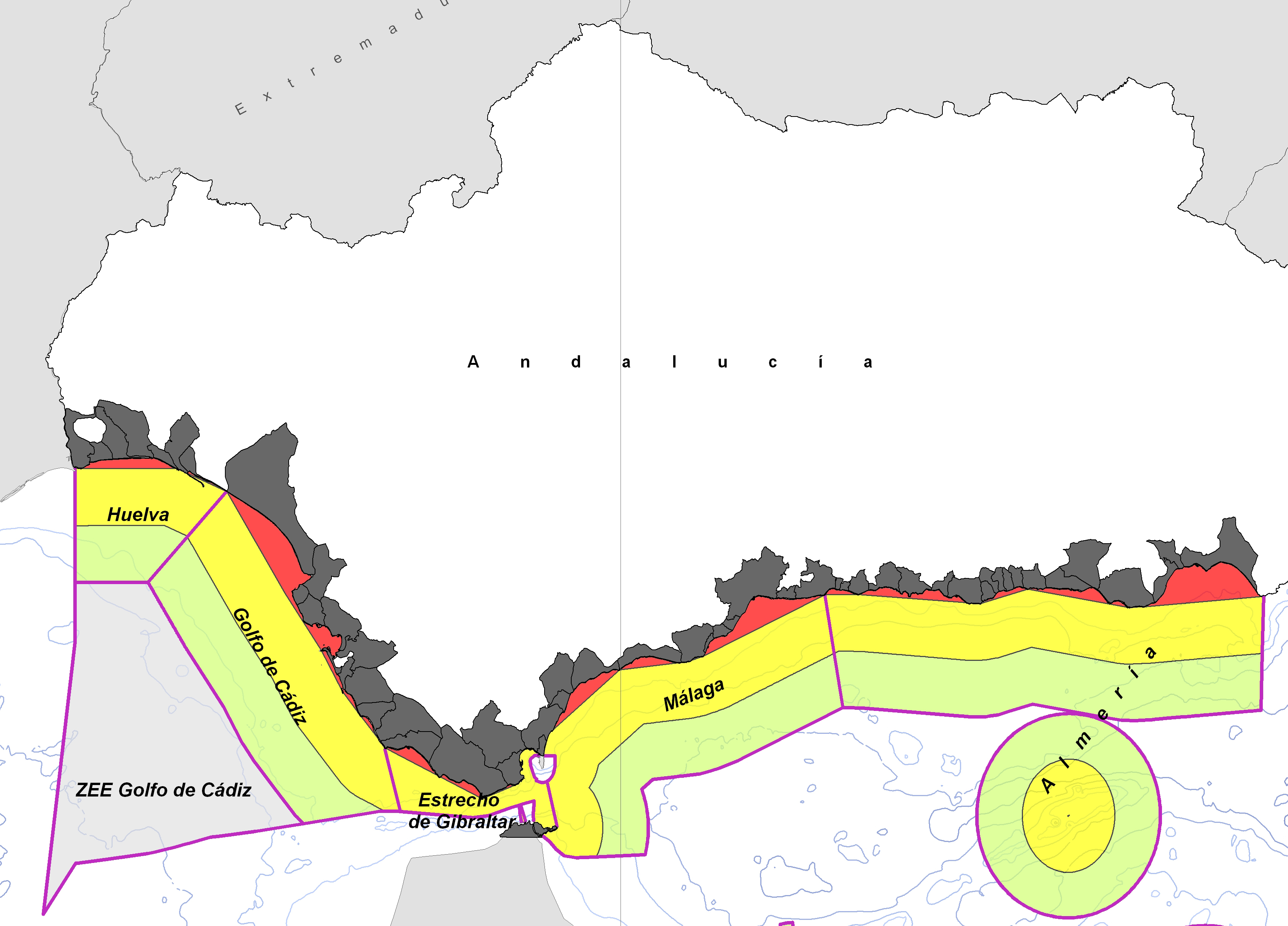
Jurisdictional waters in the Mediterranean and Black Seas
Versions in English, Spanish, French, Italian and German
UNEP/PAP/RAC. Report on Spatial Planning Systems. Spain.
English version available
Maritime geopolitical scenarios
Files .kml (Google Earth). Marine zonification in relation with institutions and planning areas.